Take a walk back in time on the short and easy route though the village of Douglas, which sits on Douglas Water.
With every step, you will encounter significant people and events in Scotland’s history from the Wars of Independence with England to World War II.
“Bloody” Claverhouse – John Graham of Claverhouse, 1st Viscount Dundee – cut off James Gavin’s ears with his own tailoring shears as punishment for attending an illegal prayer meeting during a period in the 17th century known as the Killing Times.
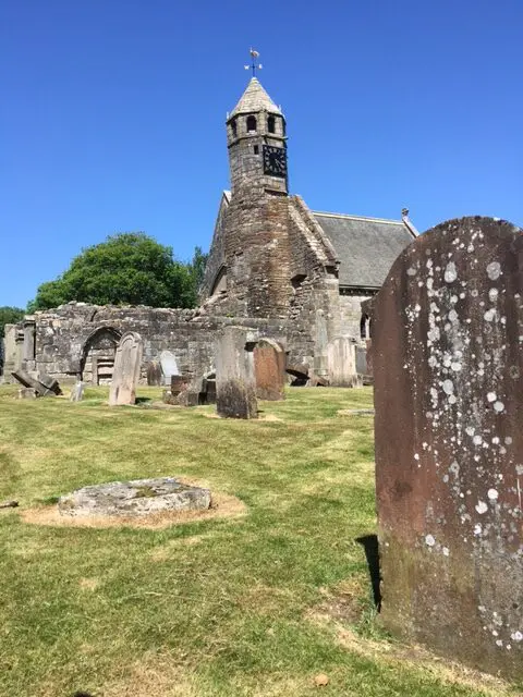
The clock in the hexagonal tower was a gift from Mary Queen of Scots and is said to be the oldest working town clock in Scotland. The remaining aisle contains the tomb of Sir James Douglas, who was Robert the Bruce’s right-hand man.
The private home is claimed as the oldest building in Douglas and has served as an inn and a courthouse. Bloody Claverhouse often stayed here when on patrol.
Carved in stone, these insignia are a lasting reminder of the exiled Polish army’s stay here during World War II.
The Cameronian regiment was disbanded here in 1968. The Angus regiment became known as the Cameronians.
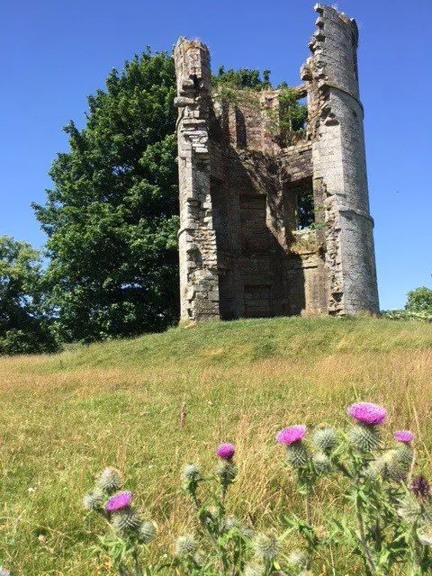
Now just a ruined tower, Douglas Castle was renamed Castle Dangerous by Sir Walter Scott. It was the scene of a particularly dastardly act during the Wars of Independence when an English patrol was tricked into believing the castle was empty. The tower was built as a folly and is not part of the original castle, which is on an adjacent site.
The Earl of Angus – who was the first Colonel of the Cameronian Regiment – points to the spot where the Angus regiment (the Cameronians) was raised in 1689.
From the Douglas Arms, walk along Main Street.
Go to the right at a newsagents, past old St Bride’s Church and the Sun Inn.
Continue downhill to the left to a lodge and enter the castle policies.
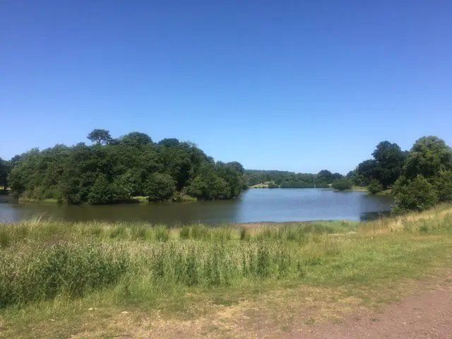
Keep to a broad track that skirts Stable Loch.
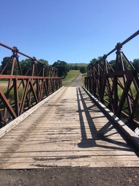
At a ruined tower (Castle Dangerous) go to the left downhill and cross iron bridge.
Walk towards a cottage and then go to the right.
Head through double gate on left and follow a track uphill through trees.
At the top of the hill, turn left and follow a forestry track. (German POWs marched along this track from their camp to the pit head baths at Douglas West.)
The track narrows and you need to squeeze through trees to join a broad track and turn left.
At remains of mine buildings, turn left downhill through light woodland.
Continue to cross Douglas Water on a blue bridge.
Skirt playing fields and follow a lane to a road. Turn right and follow the road to the rear of St Bride’s church.
Continue to Angus monument and turn left to go downhill. At the foot of the hill turn left and then right to return to start on Main Street.